What's new

Get Your Hike On! - Picture Thread

ChiefBroom

No tattoo mistakes!
Nice photos, Ken. Looks like you had a good time. I always take Hwy. 95 home from visiting my family unless I'm in a hurry. I'll be heading down to that area in a couple weeks. I hope to get some good shots to post on this thread.

Cool!

You live in a phenomenal state. I did several back-packing, slot canyon trips there when we lived in CO.
 
$122.jpg

SWMBO rock-scrambling, Werribee Gorge Circuit Walk (highest elevation, overlooking northern plains towards Bacchus Marsh)
 

Toothpick

Needs milk and a bidet!
Staff member
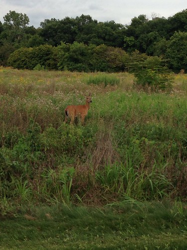
On the bike yesterday and spotted some wildlife! The deer along the trails are so used to people it didn't even move. I got off my bike walked a little closer and it just ignored me and kept eating.

 
That's pretty cool.
I know I see a lot more deer than the hunters in my area. I swear they know who's toting a gun and who's got a camera
 
Your deer and our Roos are masters of camo - really had to look for that bugger! (In my defence I'm on the iPhone and my eyes are pretty well shot too...)
 

Toothpick

Needs milk and a bidet!
Staff member
Your deer and our Roos are masters of camo - really had to look for that bugger! (In my defence I'm on the iPhone and my eyes are pretty well shot too...)
I didn't see it at first either, the chick I was with holler'd out "deer!" I was like "where" there! "oh!"
 
Yesterday I planned on doing a really big hike, but life gets in the way so I scaled it back to a more manageable 11 miles of big mountain hiking. The weather forecast for the White Mtns. is always tricky. The Presidential ridge sits just under the jest stream, with Mt. Washington poking up in to it. Yesterday called for early clearing and a rare bluebird day. So here's the 06:00 view of Mt. Jefferson. Above treeline hiking in the fog isn't my favorite past time. Sometimes you have to play the hand you're dealt.

Ugh.
$Mt. Jefferson 007.jpg

My route had my usual MO of circling a big ravine. At 4000 ft I was in the clouds with about 50 yds of visibility. Here's the dramatic view of Castle Ravine.

$Mt. Jefferson 013.jpg

The trail I was on was Castle trail. It's named such because there are two large granite spines that you have to scramble over on a very exposed ridge. I was alone, in the fog, and the rock was quite damp and greasy. I gave serious consideration to turning back. Thankfully I didn't. Here's the first and harder "Castle" that I had to deal with. I'll give it some perspective in a later picture.

$Mt. Jefferson 017.jpg

After clearing the most demanding part of the hike I refused to be denied summiting. The AMC and the RMC do an incredible job of blazing the open summits with cairns. Without them it would be like navigating the surface of the moon. Right around this picture I slipped in to a crack and almost snapped my tibia. Not the place to get injured.

$Mt. Jefferson 018.jpg

As I neared the summit cone hope of some views was restored.

$Mt. Jefferson 019.jpg
 
Finally summiting, I was treated to an incredible sea of clouds. They were alive and moving all around, flowing up the ravine walls on thermals.

$Mt. Jefferson 037.jpg

Moon over the summit cone

$Mt. Jefferson 049.jpg

Nearby Mt. Adams being overtaken by clouds.

$Mt. Jefferson 050.jpg

After about 30 minutes it was time to start down. Heading towards the east side of Castle Ravine I would be back in the cloud deck again.

$Mt. Jefferson 059.jpg

Of course, as I descended the clouds finally dissipated. I took a side trail to finally get a shot of the ravine. Here's the ridge I ascended.

$Mt. Jefferson 063.jpg
 
Last edited:
Here are the Castles that I had to deal with in the whiteout.

$Mt. Jefferson 064.jpg

The hike down was thankfully uneventful. I dread descending those peaks as the rock hopping just beats your legs to hamburger. Both my calves are so tight today. Back below treeline it was quite serene and beautiful. That's my favorite part of solo hiking. Just me in "my" sanctuary.

One of the river crossing on the Israel Ridge trail

$Mt. Jefferson 073.jpg

Towards the valley and my cold soda.

$Mt. Jefferson 075.jpg

I don't know the proper name of these fungi, but I remember seeing them on hikes when I was very young. I think we called them pipe stem mushrooms back in the day.

$Mt. Jefferson 078.jpg

Somehow I survived despite my less than perfect physical condition.

$Mt. Jefferson 079.jpg
 
I'm gasping just looking at these pictures. I used to live in Albuquerque at about 5,500 ft and then struggle to hike to the top of Sandia Mountain near ABQ, which was at 10,000 ft. But 13,000 ft?
 
I love the sign! The other pics are great too, but that one is a classic.

It's funny how they underline and make ONLY stand out :laugh:

yep, love that sign...


I call it the Vinny sign. I'm relatively sure it's intended for the completely unprepared, of which there are many. I see folks up there in t-shirts and cutoffs. No water, food, rain gear, compass, map. It's amazing. Most folks don't know that there is a guidebook that explains the perils of certain trails. Lots never check the weather.

Lots of Vinnies running loose in those parts. Some 30 something year old died last week of heat stroke on a smaller peak. Probably completely avoidable.

Sadly I'm off the trail for a few weeks. The next hike should be a big one. Not sure what yet, but definitely in the 15+ mile, 5-6k of vertical. Still trying to see if I can handle a full Presidential traverse this year. The window is starting to close. Need to fish or cut bait by the end of August.
 
Top Bottom